Monday, July 27, 2009

Kamloops Wildlife Zoo


Our stay in Kamloops was brief, but Ken found an opportunity to keep up his poop scooping skills after my trail ride in Eric Valley. The beautiful black warmblood wouldn't leave him alone. We did visit their zoo just outside our RV park and they had a nice "birds of prey" presentation. The second picture has an owl on the center post and shows the amphitheater where the birds flew loose and free right over our heads. Pictures 2 and 3 show the Harris falcon and it was really beautiful. He would fly so low over our heads that your hair would blow in the current from his wings. Picture 3 is the falcon on the rail right behind me. The last picture is a red tailed hawk. The lady was very informative and really knew how to entertain the crowd, especially with so many young children. It was a nice presentation. We had the oil changed and tires rotated on the truck here. We had put a little over 9,000 miles on the truck and over some really rough and really steep terrain.

Kamloops


Kamloops, BC, was the largest metropolitan area we have visited. The terrain in that part of British Columbia is high desert and very rugged. The city is very modern and Suzy even got a haircut. As we traveled through Cache Creek,BC, we had to choose Kamloops or Kelowna. Suzy just said Kamloops, and we were very glad we did. The day after we arrived in Kamloops they were evacuating Kelowna and the Okanagan lake area because of 3 out of control forest fires. The highways were closed, and we figure we would have been evacuated right after arriving. As a result we enjoyed our brief stay in Kamloops. Suzy got a trailride in through Erin Valley. Just her and the guide Devin. Her short little paint, Elisha, was full of life and energy, but very well behaved. The terrain was pretty rugged and we zig zagged up the mountain and had to detour often because of heavy trees blown across the trail on numerous occasions. We had come through a big rain, hail and windostorm just before we reached Kamloops. It was great fun, because we broke some new trails to detour, had to dismount once because of a huge tree along a cliff edge and got to trot and lope. The view from the summit showed two valleys and from the return road we could look up at the summit and ridge we had just circled(last photo). (PS don't ask why there are 3 of the same picture; I'll figure this out soon.)

Totems


After our trip to Stewart, BC and Hyder, AK, it was time to leave Whitehorse and theYukon Territory. As we trekked down through the Yukon and British Columbia we traveled through numerous areas known for the First Nations totem poles. We were surprised to learn that the totem poles are not an ancient tradition, although it is an old part of their culture. We stopped at one small village where they were developing their museum. The totem poles set in the ground are part of the village and represent and honor different people or families. The faces and figures and top symbols represented values or characters of the person or family. The ones outside are the newer ones, and Ken said some looked as if they had been done with a chain saw. The museum wasn't really open, but we wandered under the porch roofs and came upon some really old totem poles. They are always made out of cedar, and it would sometimes take up to 2 years to complete them. The older ones had much less detail left. If a village changed locations, the poles were left to mark the place they left. We also learned that some totem poles were for the interiors, as support poles or at the entrance to lodges. With the appearance of white settlers, paint became available and was used to enhance some of the figures. Wish we had had more time to explore more of these.

Houston & Deer Park


Yes, we made it to Houston, but Houston, British Columbia, on our trek back toward the states. Had to get a picture of Mr. Squirrel with the Houston sign. Their claim to fame is the largest fishing rod in the world. Ken had to have his picture with it to give it perspective. We visited their community market and, to Ken's delight, a Mennonite lady had bags of homemade egg noodles like his mother used to make. They discussed the process, including the use of brown free range eggs. He bought all she had of the small noodles. We have some soups to make when we get home. We stayed overnight and the RV park was really pretty. The flowers in these northern regions are just gorgeous. Their colors are so vibrant and deep that they look fake. They aren't fake, but indeed very real. The wooden pot with blue flowers is made from a hollow tree trunk. The gnarly growths on each side of the trunk are called "burls" and they often remove the burls to make beautiful bowls out of them.

Looking at our direction back into Washington state and into Idaho, we found Deer Park, Washington, so we had to drive through it. Not much there, very small but pretty. We barely got the picture showing the sign.

Tuesday, July 21, 2009

incredible Salmon Creek Glacier


July 15 You pay your dues to get to the summit and view the glacier, more on the road elsewhere, but the view is incredible. I knew very little about glaciers but know they are hundreds of feet thick with a flow pattern or textures and crevices and beautiful blue, especially icey aqua blue, streaks. I was never interested in glaciers, but have decided they are pretty impressive. Photo 1 shows one frozen flow between the mountains with the crevice and photo 2 is the same view, but notice the deep crevice and blue colors. I hope the colors show up. Photo 3 is from the summit and shows the curve of the main body and thickness. Photo 4 is the same view from the summit but shows how high the elevation is with the clouds below the mountain tops. The last photo is from the summit and is the right flow with the heavy textures and crevices and change in colors. It was a most breathtaking and humbling sight.

Salmon Creek Glacier summit


After the torturous road trip up, the glacier was unbelievable. I have never been really interested in glaciers, but I see now their humbling intensity. Our first glimpse of the glacier, photo 1 from the window, was what they call a toe, or part of it between ridges of the mountain. When we reached the summit, photo 2, Ken got a panoramic view with the video camera to show the extensions of the glacier. Notice the clouds across from him below the mountain top. and the glacier below. It's good Ken's arms are so long. There was no one to take our photo together, but we did get it with the glacier curving behind us. It has intense aqua and blue colors streaking through it. Ken found one small dome at the summit and his expression says it all. The view was incredible. Now, thanks to Ken, there is one large snow angel left along the roadside. Who knows how long it will last.

Salmon Creek Glacier


July 15 we headed up the road from Hyder to the summit above Salmon Creek Glacier. The road combined the worst of all the other roads we traveled. Gravel, rugged with ridges, steep up and down, twisting and very narrow with tremendous roadside cliffs straight down. It wasn't much fun. Photo 1 shows, behind the truck, the steep winding road that we have been following and snow packs still at that elevation. Photo 2 shows the thickness of some of the ice packs and many are melting from the underside and could slide right out across the road. Photo 3 shows more of the winding narrow road, the steep drop off and snow. Going up we noticed a hole, thank goodness, on the downhill side and someone had stuck a limb in it to mark it. The hole is about 3 feet across, 4 feet deep with a tunnel 2 feet to the right and the steep dropoff. Photo 5 is just one of the outstanding views we would encounter as we rounded a turn and looked across the deep valley at the mountains. Coming down was a little less intimidating, and as much as we would have liked to see the glacier again, neither one of us wanted to experience that road again. We went late in the afternoon to avoid the crowds and luckily we met only one car coming or going.

Hyder, AK bear observing


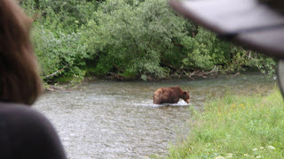
We spent several days in the minute Hyder area and enjoyed the observation platforms along Fish Creek where the salmon run and the black and grizzly bears come to feed on the fish and the berries. Photo 1 shows the platform from the far end, looking back at the entrance. Notice how high it is above the creek and the heavy brush underneath, much of it full of berries. Photo 2 is Ken watching the immense salmon in the creek. The black bears come down through the trees and underbrush to avoid the grizzlies who will kill them. The 3rd photo is our peekaboo black bear. That is about all of the black bear that we saw; he spent quite a while shaking all of the brush as he ate the berries. The grizzlies will come walking right up the middle of the creek, fishing as they go. Photo 4 shows a grizzly approaching the area, just meandering up the creek and photo 5 shows how close he came to the viewing deck. He stayed around awhile, left and returned for another fishing tour. The grizzly was quite intimidating even from that viewpoint.

isolated Hyder, Alaska, another world


The only road that goes in and out of Stewart, British Columbia, follows the cliffs and coast to Hyder and dead ends there. Hyder once had about 15,000 people but now has about 100, during the summer. There are more deserted, dilapidated buildings than inhabited ones. It is difficult to determine which ones are inhabited and which ones aren't. Photo 1 shows main street toward Stewart through customs at the far end, from "downtown". To say it has dirt streets is an understament, with weeds and brush roadside and filling yards. There are some unique homes here and as always, there's the post office. Their claim to fame and existence is the bear observation area along Fish Creek and Salmon Creek glacier. Ken is checking out the huge salmon along the bridge of Fish Creek. The other side of the bridge is where the bear observation platforms are.

Stewart, BC and Hyder, Alaska harbor


The harbor of Stewart, BC and Hyder, Alaska, is a huge inlet from the Pacific Ocean and was once a major shipping and traffic center. There is only one road into Stewart and that road follows the coast to Hyder, Alaska where it dead ends. The two towns are about a mile apart along the cliffs and an avalanche cuts Hyder off. Our fishing guide, Ron, was very informed about the mining and history of the area. Photo 1 shows the harbor where it comes to Stewart and there's not much there anymore. Notice the mountains come right down to the shore. There were 40,000 people living in those mountains during the gold rush. The second photo shows the entrance to an old mine. He pointed out numerous mines along the harbor, but most were way up the sides of mountains and barely visible now. How they got up there to mine I will never understand. It was an overcast day, but in the 3rd photo along the ridge is a glacier coming down maybe 1/4 of the way; the grey center strip left to right, just above the bits of snow. The glacier filled the area down to the "smiley face", as Ken called it, just above the trees, when Ron came to the area in 1974. It has shrunk that much. In photo 4 the mist makes it a bit difficult, but on the right side, in a tree, you can see the white heads of a pair of bald eagles. There is a nest behind some of the trees in that area. We saw 5 different bald eagles that day. They were magnificent. Finally, on our trip in, we saw the black bear in photo 5. Ron said it was quite typical to see them along the shoreline each day he went fishing and he occasionally would see the white bear. It isn't unusual to see seals and whales also, but it wasn't our luck on that day.